New technologies and changing demands are driving a paradigm shift in modern surveying. Rapid technological development extends beyond measurement to include computing, communications and geospatial data mapping.
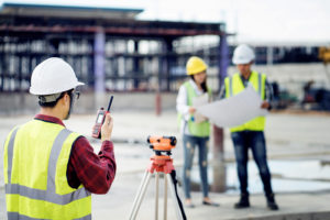
For millennia, surveyors have fulfilled the need to mark property boundaries, conduct reconnaissance and make maps for planning. As economies and populations grew, surveyors kept up with the increased demands for broader knowledge and higher accuracy. Today, we are witnessing technical advances that affect surveyors in unanticipated ways. The rapid technological advances extend beyond measurement to include computing, communications and geospatial data mapping. These changes have made geographic information more accessible. As a result, society has placed increased importance on accurate, timely and user-friendly geospatial information. To meet the demands, the role of a surveyor is changing rapidly. Far beyond the time-honoured practices of property and construction measurement, surveying has grown to include managing, interpreting, analysing and portraying spatial information. The surveyor must guide geospatial data consumers working in a variety of related disciplines. Through it all, the surveyor must maintain a high level of data integrity.


